© Reed Parish Council 2025
Website Accessibility Statement
Reed Village
The website of Reed Parish Council

Reed Village
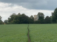
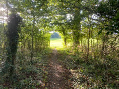
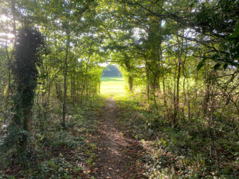
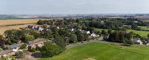
Reed sits on a chalk ridge at almost the highest point in Hertfordshire. The village is about 3 miles south of Royston, 15 miles south of Cambridge and 35 miles north of central London. A settlement has reportedly existed at Reed for 2,000 years, and the community was mentioned in the Domesday Book of 1086 (as Retth). According to the 2021 Census, 343 people lived in the village in 144 households. Reed is built in an unusual pattern around a central meadow. High Street marks the east of this square, Jackson’s Lane the north, Church Lane the west and Driftway the south. This shape helps give Reed its open and spacious appearance. Just to the east of the village is the Prime Meridian, also knows as the Greenwich Meridian - which marks zero degrees longitude and the boundary between the eastern and western hemispheres. This means that Reed is in the western hemisphere, whereas neighbouring Barkway is in the eastern! The Greenwich Meridian Trail - a long-distance footpath - passes through Reed, although it doesn’t follow the meridian exactly. Just to the west of the main part of the village, the A10 road follows the route of the Roman Ermine Street, which ran from London (Londinium) to Lincoln (Lindum). Reed is noted for its ponds and moats, including some which are scheduled ancient monuments. Some of these are associated with long-lost hamlets and settlements with names like Gannock Grove, Fiddler’s Green and Billingsgate. You can find these marked on a good map, although most of them lie on private land. Around the village are various ancient woodlands, including Bush Wood, Rokey Wood, Sallow Wood and Roundabout. Well-marked footpaths afford enjoyable country walks around the village, and the Hertfordshire Way passes through the parish. Any good map will show you the footpaths, but it’s well worth checking the definitive map to be sure. A new informative sign, soon to be installed on Reed Green opposite the village hall, will also show the footpaths. Wonderful views are available, especially from Reed Joint looking north towards the Cambridgeshire Fens. You can see Cambridge quite easily, and on a clear day you can even see the tower of Ely Cathedral, some 30 miles away. Sharp-eyed observers looking to the north-east might spot some of the turbines associated with the Wadlow wind farm near West Wratting, about 17 miles away. But if you stop to admire the view in the winter, wrap up warm. Local legend has it that there’s no higher land between Reed Joint and the Urals. Probably not true - but it can feel like that!Reed highlights
St Mary’s Church
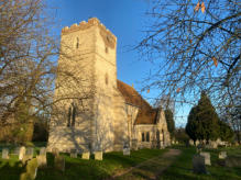
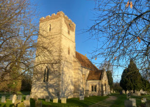
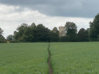
Walk south on Church Lane for a couple of hundred yards beyond Driftway to find the tiny church of St Mary. This lovely little church is recorded in the Domesday Book, and it’s quite a thought that it has been a place of worship for Reed villagers for over a thousand years. It remains so today. It has been renovated and extended many times over the centuries, most recently over the last fifteen years - a programme largely funded by private donations and through the Friends of Reed Church. After visiting the church, see if you can spot the owl nesting boxes in the churchyard. A smaller chapel for non-conformist worshippers stood on Church Lane near Driftway. It has recently been rebuilt as a private residence.Queenbury
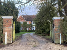
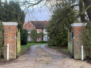
Queenbury stands on the corner of Church Lane and Driftway. One of two manor houses in Reed, the other being Reed Hall, Queenbury is thought to be named for its association with Queen Eleanor, the mother of Edward I, and later Anne Boleyn, one of the wives of Henry VIII. Queen Eleanor granted lands in Reed to fund St Katharine’s Hospital in London, and the hospital was probably saved from dissolution by Anne Boleyn. The hospital sold the land in the late 19th century. Another fascinating story is that during World War II, “land girls” posted to Reed were billeted there.Reed Green and the Cricket Club
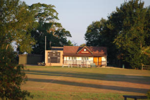
If you visit Reed in the summer, especially at weekends, you will more than likely find the Green busy with people playing or watching cricket, as enthusiastic shouts of “Howzat!” echo around the village. Reed Green hosts a successful village cricket club, but it wasn’t always like that. During World War II the Green was used as arable land, and the cricket club pavilion displays photographs of what the land was like in those days and how it was converted to the Green we now enjoy. The present club dates from 1956. Before that, cricket used to be played on the fields behind The Cabinet, and it’s thought that the game has been played in Reed for more than a hundred years.Reed School
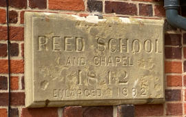
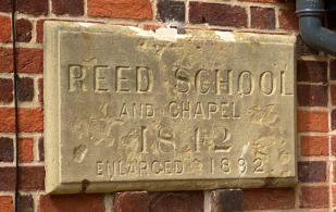
Reed Chapel - the non-conformist place of worship mentioned above - was the site of the school for local children until the late 19th century, when it closed. Children then had to walk to school across often muddy fields to Barkway. Unsurprisingly, this took its toll on attendance, especially in the winter. In 1913 the present Reed School opened on land donated by a local family. Today it remains a flourishing first school. Support for local schoolchildren is provided by the Friends of Reed School.The village sign
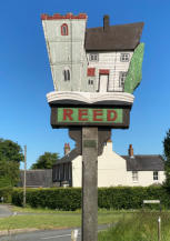
The village sign, on the Green opposite the village hall, was erected in the year 2000 and was funded by the Turney family. It features St Mary’s Church, The Cabinet, and, on the reverse, illustrations of reeds (after the name of the village) and trees, commemorating the local woodlands, and an open book to symbolise the Domesday Book. The sign has recently been renovated and was restored to The Green during the weekend celebrating The Queen’s Platinum Jubilee.The Cabinet
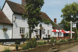
The 400-year old Cabinet is Reed’s last pub, and of all the hostelries that existed in Reed, it was the only one to survive into the 21st century. It is thought to be the only pub in the country bearing the name. The word Cabinet means small room or meeting place, and it is thought to have been constructed as a meeting room for the Huguenot population in the area. Evidence indicates that there has been a public house in Reed since at least 1657, although it’s not clear whether that is the present Cabinet. What is clear is that the Cabinet provided a place of refuge and refreshment for some four centuries and generally thrived until 2011. Unfortunately, a substantial amount of money was stolen from the takings, leaving the publican unable to pay the bills, and the pub closed in 2011. Since 2016 it has been the subject of a series of controversial and disputed planning applications which continue to this day. Part of it is open as a bar, restaurant and takeaway. A community action group has been leading efforts to the save the pub as a whole.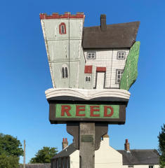
© Reed Parish Council 2024
Website Accessibility Statement
Reed Village
The website of Reed Parish Council

Reed Village
Reed sits on a chalk ridge at almost the highest point in Hertfordshire. The village is about 3 miles south of Royston, 15 miles south of Cambridge and 35 miles north of central London. A settlement has reportedly existed at Reed for 2,000 years, and the community was mentioned in the Domesday Book of 1086 (as Retth). According to the 2021 Census, 343 people lived in the village in 144 households. Reed is built in an unusual pattern around a central meadow. High Street marks the east of this square, Jackson’s Lane the north, Church Lane the west and Driftway the south. This shape helps give Reed its open and spacious appearance. Just to the east of the village is the Prime Meridian, also knows as the Greenwich Meridian - which marks zero degrees longitude and the boundary between the eastern and western hemispheres. This means that Reed is in the western hemisphere, whereas neighbouring Barkway is in the eastern! The Greenwich Meridian Trail - a long-distance footpath - passes through Reed, although it doesn’t follow the meridian exactly. Just to the west of the main part of the village, the A10 road follows the route of the Roman Ermine Street, which ran from London (Londinium) to Lincoln (Lindum). Reed is noted for its ponds and moats, including some which are scheduled ancient monuments. Some of these are associated with long-lost hamlets and settlements with names like Gannock Grove, Fiddler’s Green and Billingsgate. You can find these marked on a good map, although most of them lie on private land. Around the village are various ancient woodlands, including Bush Wood, Rokey Wood, Sallow Wood and Roundabout. Well-marked footpaths afford enjoyable country walks around the village, and the Hertfordshire Way passes through the parish. Any good map will show you the footpaths, but it’s well worth checking the definitive map to be sure. A new informative sign, soon to be installed on Reed Green opposite the village hall, will also show the footpaths. Wonderful views are available, especially from Reed Joint looking north towards the Cambridgeshire Fens. You can see Cambridge quite easily, and on a clear day you can even see the tower of Ely Cathedral, some 30 miles away. Sharp-eyed observers looking to the north-east might spot some of the turbines associated with the Wadlow wind farm near West Wratting, about 17 miles away. But if you stop to admire the view in the winter, wrap up warm. Local legend has it that there’s no higher land between Reed Joint and the Urals. Probably not true - but it can feel like that!Reed highlights
St Mary’s Church
Walk south on Church Lane for a couple of hundred yards beyond Driftway to find the tiny church of St Mary. This lovely little church is recorded in the Domesday Book, and it’s quite a thought that it has been a place of worship for Reed villagers for over a thousand years. It remains so today. It has been renovated and extended many times over the centuries, most recently over the last fifteen years - a programme largely funded by private donations and through the Friends of Reed Church. After visiting the church, see if you can spot the owl nesting boxes in the churchyard. A smaller chapel for non-conformist worshippers stood on Church Lane near Driftway. It has recently been rebuilt as a private residence.Queenbury
Queenbury stands on the corner of Church Lane and Driftway. One of two manor houses in Reed, the other being Reed Hall, Queenbury is thought to be named for its association with Queen Eleanor, the mother of Edward I, and later Anne Boleyn, one of the wives of Henry VIII. Queen Eleanor granted lands in Reed to fund St Katharine’s Hospital in London, and the hospital was probably saved from dissolution by Anne Boleyn. The hospital sold the land in the late 19th century. Another fascinating story is that during World War II, “land girls” posted to Reed were billeted there.Reed Green and the Cricket Club
If you visit Reed in the summer, especially at weekends, you will more than likely find the Green busy with people playing or watching cricket, as enthusiastic shouts of “Howzat!” echo around the village. Reed Green hosts a successful village cricket club, but it wasn’t always like that. During World War II the Green was used as arable land, and the cricket club pavilion displays photographs of what the land was like in those days and how it was converted to the Green we now enjoy. The present club dates from 1956. Before that, cricket used to be played on the fields behind The Cabinet, and it’s thought that the game has been played in Reed for more than a hundred years.Reed School
Reed Chapel - the non- conformist place of worship mentioned above - was the site of the school for local children until the late 19th century, when it closed. Children then had to walk to school across often muddy fields to Barkway. Unsurprisingly, this took its toll on attendance, especially in the winter. In 1913 the present Reed School opened on land donated by a local family. Today it remains a flourishing first school. Support for local schoolchildren is provided by the Friends of Reed School.The village sign
The village sign, on the Green opposite the village hall, was erected in the year 2000 and was funded by the Turney family. It features St Mary’s Church, The Cabinet, and, on the reverse, illustrations of reeds (after the name of the village) and trees, commemorating the local woodlands, and an open book to symbolise the Domesday Book. The sign has recently been renovated and was restored to The Green during the weekend celebrating The Queen’s Platinum Jubilee.The
Cabinet
The 400-year old Cabinet is Reed’s last pub, and of all the hostelries that existed in Reed, it was the only one to survive into the 21st century. It is thought to be the only pub in the country bearing the name. The word Cabinet means small room or meeting place, and it is thought to have been constructed as a meeting room for the Huguenot population in the area. Evidence indicates that there has been a public house in Reed since at least 1657, although it’s not clear whether that is the present Cabinet. What is clear is that the Cabinet provided a place of refuge and refreshment for some four centuries and generally thrived until 2011. Unfortunately, a substantial amount of money was stolen from the takings, leaving the publican unable to pay the bills, and the pub closed in 2011. Since 2016 it has been the subject of a series of controversial and disputed planning applications which continue to this day. Part of it is open as a bar, restaurant and takeaway. A community action group has been leading efforts to the save the pub as a whole.